15 Best Day Hikes in the Northeast

These day hikes are not pretenders. We surveyed the northeastern U.S.

15-best-dayhikes-gear-patrol-lead-full

Most day-long โ€œhikesโ€ are actually just long walks in disguise. Add some loose rocks and maybe a view or two of some nice trees and people starting throwing out the H word. The following hikes are not pretenders. We surveyed the northeastern U.S. to find the best 15 day hikes spread out across nine states. If you have a car (in some cases you donโ€™t even need one), you can find an accessible 10 miler with manageable distances, notable views and unique trails for a long, fulfilling Saturday. Get out there now and thank us later.

MORE HIKES The Mountain Series | 5 Best American Peaks | Hiking The White Mountains

Connecticut


Boats and I-95


Lionโ€™s Head to Bear Mountain

How Long: 13 miles
Found In: Salisbury, Connecticut
Which Is: 90 minutes north of Bridgeport; 75 minutes southeast of Albany
The Draw: Bear Mountain is the highest peak in Connecticut, and hiking to it from Lionโ€™s Head โ€” along the Appalachian Trail โ€” is the best way to get to the summit.
Donโ€™t Miss: The 22-foot stone pyramid at the summit and views of the Catskills in New York and Mt. Everett in Massachusetts.

Maine


Basically a Visit to Canada


Summit Mt. Katahdin via Knife Edge

How Long: 9.5 miles
Found In: Baxter State Park, Maine
Which Is: 4 hours north of Portland
The Draw: Running from Pamola Peak to Baxter Peak, the actual Edge is only about a mile, but the views of the 100-Mile Maine Wilderness as you walk along its spine make it well worth the trek.
Donโ€™t Miss: Your footing. This hike isnโ€™t for windy days or hikers with vertigo. Exercise extreme caution along the edge and donโ€™t roll off the cliff.

Gulf Hagas Trail

How Long: 8 miles
Found In: Northeast Piscataquis, Maine
Which Is: 3.5 hours north of Portland
The Draw: The โ€œGrand Canyon of the Eastโ€, Gulf Hagas Trail is accessible from one of the most remote sections of the Appalachian Trail and passes cascading waterfalls and deep gorges.
Donโ€™t Miss: The part where we said this is remote. Bring a friend, a plan, well-draining shoes for river crossing and cash to pay the gate fee for access via Katahdin Iron Works Road.

Ocean Path and Precipice Trail

How Long: 4 miles and 2.5 miles
Found In: Acadia National Park, Maine
Which Is: 3 hours northeast of Portland
The Draw: On the eastern coast of Acadia National Park (a treasure in its own right) lies Sand Beach. The Ocean Path, an easy walking trail, runs south from Sand Beach, running along cliffs that drop into the crashing waves of the north Atlantic. A mile north of the beach is Precipice Trail (closed during early summer), which is essentially a ladder fastened into the side of a cliff overlooking the park and open ocean.
Donโ€™t Miss: Bringing a camera. These hikes are relatively painless and provide disproportionately stunning views.

Massachusetts


Terrible Accents, Better Trails


Mt. Tom Traverse โ€“ Metacomet-Monadnock Trail

How Long: 6.5 miles
Found In: Holyoke, Massachusetts
Which Is: 90 minutes west of Boston
The Draw: Mt. Tom is the highest traprock peak in the Metacomet Range, which stretches from Connecticut through Massachusetts and looks out over the Connecticut River. Mt. Nonotuck, a few miles north of Mt. Tom, features the Eyrie House ruins โ€” remnants of a summit hotel that burned down in 1901.
Donโ€™t Miss: The wreckage of a U.S. Army Air Force B-17G Flying Fortress, which crashed into the north side of the mountain on July 9th, 1946.

Great Blue Hill in the Blue Hills Reservation

How Long: 1.5-10 miles
Found In: Milton, Massachusetts
Which Is: 20 minutes south of Boston
The Draw: Blue Hills Reservation is reachable by Bostonians via public transportation and offers 10 miles of trails during the summer and skiing during the winter.
Donโ€™t Miss: Eliot Tower at the Great Blue Hill summit looks north over the skyline of downtown Boston.

New Hampshire


Live Free or Die, Sucka


Welch and Dickey Mountain Loop

How Long: 4.5 miles
Found In: Thornton, New Hampshire
Which Is: 75 minutes north of Manchester
The Draw: Hiking the White Mountains will generally humble your thighs and knock you on your ass. This hike is an exception. Short and easy to access, it runs on the southern end of the White Mountains.
Donโ€™t Miss: After hiking through pines and blueberry shrubs and atop slabs of granite, youโ€™ll summit to views of Franconia Ridge โ€” another amazing hike on this list. Bring cash for parking.

The Presidential Traverse

How Long: 23 miles (one way)
Found In: Northern White Mountains, New Hampshire
Which Is: 1 hour 45 minutes north of Manchester
The Draw: Being able to say youโ€™ve done it. This hike is not a joke. Completion means summiting the seven mountains along the range named for presidents: Madison, Adams, Jefferson, Washington, Monroe, Eisenhower and Pierce.
Donโ€™t Miss: The number on your bathroom scale, big guy. Be realistic; if you need to spread this hike across a long weekend, know that camping above the tree line is prohibited and finding a flat, suitable camping area can prove difficult in the Whites.

Mt. Moosilauke via Beaver Brook

How Long: 8 miles
Found In: Western White Mountain National Park, New Hampshire
Which Is: 90 minutes north of Manchester
The Draw: Hike up next to the Beaver Brook Cascades and lose your shit over 360 degree views of the White Mountains, Connecticut River and Vermont at the summit of Moosilauke.
Donโ€™t Miss: Cairns โ€” huge man-made rock piles โ€” litter the summit. Bring cash for parking at the Ravine Lodge Trailhead.

New Jersey


Most Densely Populated State, But Still Hikeable


Mt. Tammany at the Water Gap

How Long: 11.5 miles
Found In: Hardwick, New Jersey
Which Is: 75 minutes west of Newark
The Draw: The hike to the top of Mt. Tammany is short but smacks your eyeballs with an amazing view of the Delaware Water Gap, a mecca for geographic diversity and rock climbing.
Donโ€™t Miss: The route past Mt. Tammany, along Kittatinny Ridge, takes you to Sunfish Pond, which is a glacial lake trapped high up among mountain foliage.

New York


More Than Just the City


Breakneck Ridge

How Long: 4-12 miles
Found In: Hudson Valley, New York
Which Is: 1 hour 40 minutes via train north of Grand Central Station
The Draw: This is the most popular hiking spot in New York, with loops of varying mileage and easy accessibility by car or train.
Donโ€™t Miss: Buying a return ticket. There is an entire stop on the Metro North Hudson Line โ€” called Breakneck Ridge โ€” devoted to New Yorkers trekking on the ridge, but no ticket machine. Figures.

Black Mountain Loop at Lake George

How Long: 7 miles
Found In: Lake George, New York
Which Is: 4 hours north of NYC; 75 minutes north of Albany
The Draw: Black Mountain is the highest peak overlooking Lake George, an elongated 32-mile stretch of water that Roosevelts, Vanderbilts, Whitneys and Rockefellers visited in the early 20th century. Today, millionaire mansions and high-dollar resorts dot the shoreline.
Donโ€™t Miss: The chance to take a hot air balloon up over the water.

Pennsylvania


Philly On One Side, Pittsburgh on the Other, Green in the Middle


Pulpit Rock โ€“ Pinnacle Loop

How Long: 9 miles
Found In: Albany, Pennsylvania
Which Is: 90 minutes northwest of Philadelphia
The Draw: Of the 230 miles of Appalachian Trail running through Pennsylvania, this nine-mile stretch features the two best views โ€” Pulpit Rock and Pinnacle Rock.
Donโ€™t Miss: Your alarm clock. This hike is popular, so if you donโ€™t want some random Sasquatch photobombing your summit photo, come early.

Rhode Island


Day-Hike the Entire State


Cliff Walk

How Long: 3.5 miles
Found In: Newport, Rhode Island
Which Is: 45 minutes south of Providence
The Draw: This was the first National Recreational Trail in New England and winds past the cliffs of Sheep Point Cove and the architecture of Newportโ€™s Historic District.
Donโ€™t Miss: The Colonial architecture, local museums or White Horse Tavern โ€” the oldest tavern still serving drinks in the entire U.S.

Vermont


Surprisingly Different from New Hampshire


Mt. Mansfield via Sunset Ridge Trail

How Long: 6.5 miles
Found In: Underhill, Vermont
Which Is: 1 hour east of Burlington
The Draw: The highest and most visited summit in Vermont is Mt. Mansfield, and the most scenic route to the top is the Sunset Ridge Trail.
Donโ€™t Miss: The mountain resembles a face (at least, as much as rocks, trees and snow can) and there are 200 acres of Arctic Tundra left behind from the last Ice Age. Bring cash for parking in Underhill State Park.

Bushwhacked Honorable Mentions
Zoar Trail along Prydden Brook, Newtown, CT โ€” 30 minutes north of Bridgeport, CT; 75 minutes northeast of NYC
Mt. Bond โ€” White Mountain National Forest, Franklin, New Hampshire
Franconia Ridge โ€” White Mountain National Forest, Franconia, New Hampshire
Green Trail in Cheesequake State Park โ€” 30 minutes south of Newark
Watkins Glen State Park โ€” 90 minutes from Syracuse or Rochester, New York
Turkey Trail in Leonard Harrison State Park โ€” Wellsboro, Pennsylvania
Camelโ€™s Hump via Alpine and Monroe Trail โ€” Huntington, Vermont

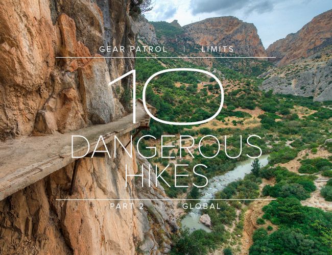
10-most-dangerous-hikes-gear-patrol-lead
,